
A pilot of our accessibility assessment was done on busy Minneapolis corridors. We efficiently mapped sidewalk and crosswalk conditions using technology combining data from cameras, LiDAR, GPS, accelerometers, and gyroscopes. The resulting GIS condition maps showed both panel-level resolution and aggregation to block-level scores.
Condition Maps
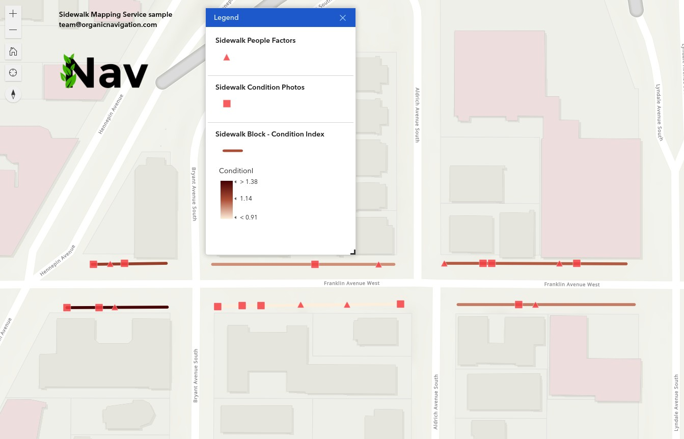
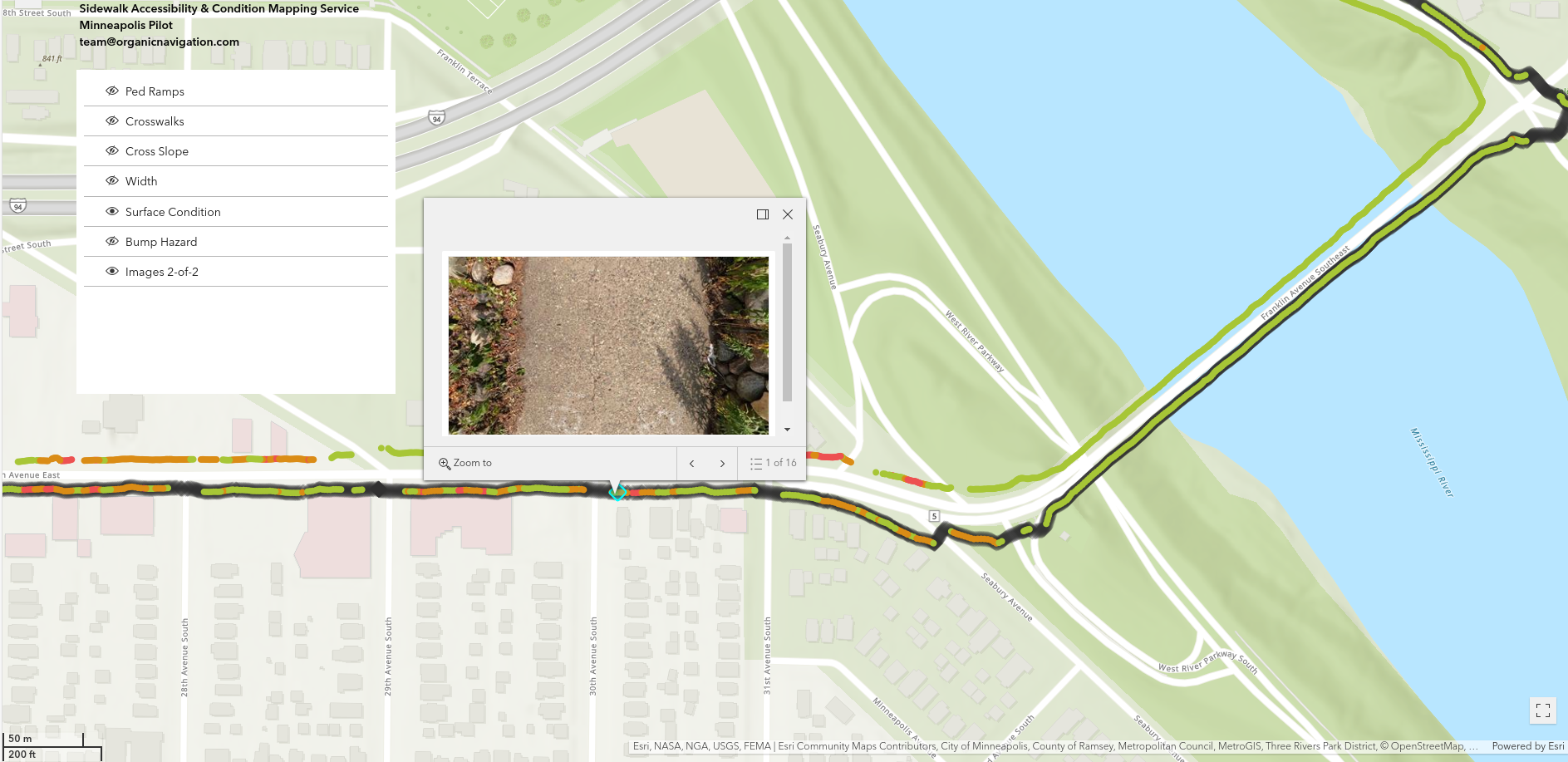
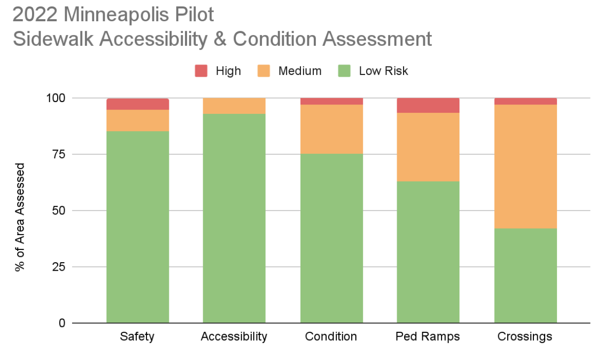
Condition Summary
2022 Corridor Description
- The east end has single-use trails along the Mississippi river, crossing the Franklin Avenue Bridge. This bridge was extensively rehabilitated around 2017 and is in good condition.
- West of the river, near the intersection of Riverside Avenue is a mix of apartment complexes and businesses, including a gas station on the north side and the very busy Seward Community Co-op grocery store on the south side of Franklin Avenue. A number of pedestrian ramps were upgraded in this area, though the condition of the intermediate sidewalks are highly varied.
- Further west is again a mix of residential and business, with the south side predominantly small retail businesses.
- The south-west corner enters to the car-free Milwaukee Avenue neighborhood. A noticeable change occurs over just a short distance from the bustling Franklin Avenue to a peaceful block of historic homes.