
Article Context
Our last article introduced the growth of GNSS correction services as an important trend to watch this year. These services enable centimeter-level positioning accuracy, an astonishing 100x improvement over the meter-level accuracy of standard GNSS. We now dive deeper into this, namely to cover what exactly are GNSS correction services and the big changes since the emergence and rapid growth of GEODNET.
Earlier this year we joined the GEODNET network and experienced first-hand how this service will be different. Certain elements of the service aligned with our perspectives and thus kept us interested. Navigation and GNSS sensing is among our core technologies and we understand the value provided by GEODNET. Blockchain and reward token economics are new to us, and arguably, the extended navigation business community. Having combined these two technologies, GEODNET is now the world's largest GNSS RTK network, and they have accomplished this in an unprecedented way. This deserves attention. With that, we present to you this two-part article where we answer the following questions:
- Part 1: What are RTK Networks and GNSS Correction Services? (this article)
- Part 2: What is GEODNET and How Did it Grow So Fast?
In these articles we will cover terms like base stations, CORS Network, RTK, PPK, and PPP as well as DePIN, blockchain, space weather miners, and GEOD tokens.
If you like this insight, subscribe for more.
Basic Standalone GPS or GNSS
Standalone GPS or GNSS receivers provide position to within a few meters of accuracy. Methods for improving GNSS accuracy have been developed and used for more than 30 years. This 1993 ION paper titled Centimeters in the Field, A users Perspective of Real-Time Kinematic Positioning in a Production Environment is a testament to the age of this technology.
Basic GNSS RTK
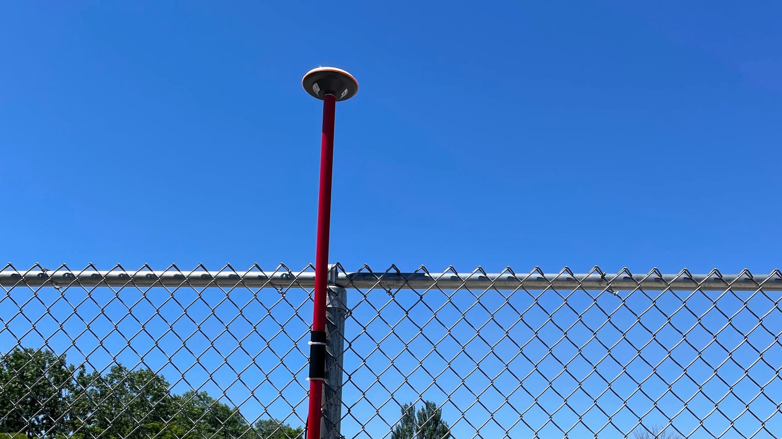
Using satellites that are more than 20,000 km overhead, Real-Time Kinemetic (RTK) GNSS can provide an astonishing centimeter-level accurate position measurement. The most basic implementation of RTK GNSS requires two receivers:
- The receiver where the position measurements are desired (e.g. the antenna on a survey pole, drone, car, tractor, phone...).
- A static receiver fixed to the earth and roughly nearby (e.g. < 20 km is typical).
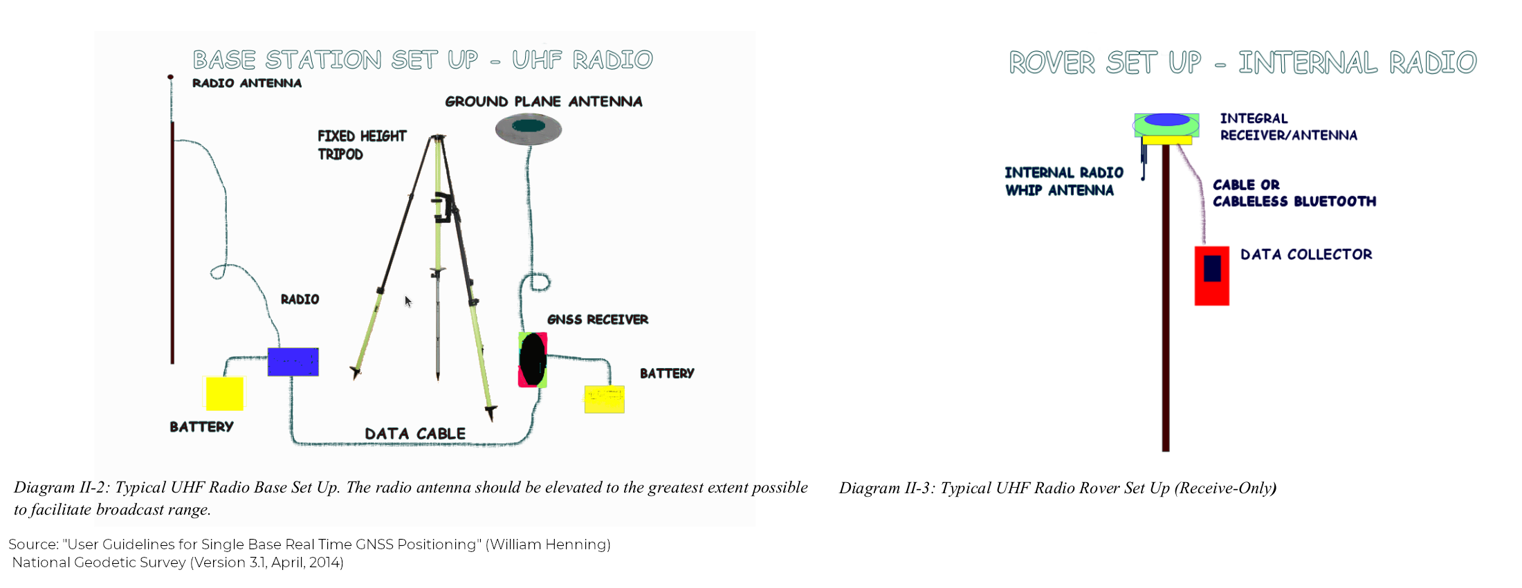
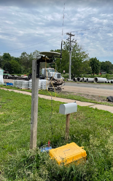
In GNSS RTK terminology, the later is called the "base" and the former is called the "rover". In order to apply RTK algorithms at the rover, raw GNSS measurements from the base must be transmitted to the rover. So a radio or communication protocol is required to get the base station measurements to the rover. Below is a diagram of this basic setup as well as a 2024 picture showing how this is used today.
GNSS RTK Networks
Given the many utilities of RTK GNSS, networks of permanent base station installations began to emerge. A basic installation had all the components shown previously:
- GNSS antenna & receiver
- Communication line for transmitting raw measurements
- Power, cables, and a weather appropriate enclosure
But this time the temporary tripod is replaced with a more permanent structure for the antenna mount. These were called Continuously Operating Reference Stations or CORS for short. Many of these were government funded and managed. Access was free with a basic registration process. When operating a GNSS receiver nearby (i.e a rover), there was no need to setup a base station. Instead, establish a data connection to the RTK network and request the raw measurements from the closest GNSS CORS. The rover could use that data to compute and apply GNSS corrections and enable RTK accuracy. Pretty neat.
The owners of these networks picked the location of these base stations for the purposes that mattered to them. A grid-like distribution over a particular state or province was typical with additional density on important geographic features (e.g. mountains or shores) or transportation corridors (e.g. major highways or ports).
A few specialized service providers extended these networks by adding CORS stations to commercially significant areas. For example, near oil wells, marine operations, mining pits, or urban centers. These commercial GNSS networks often aggregated public CORS data, added to that private CORS stations, and provide enterprise-level access. Easy integration with their specific hardware was common and that combination of hardware and software subscription was sold to their customers. Thankfully enough standardization emerged that most GNSS RTK Networks are interoperable with receivers from different vendors. For example, a government managed CORS station using a Trimble receiver could supply corrections to a Septentrio GNSS receiver. Hence, GNSS RTK networks have expanded and with that so has their offerings.
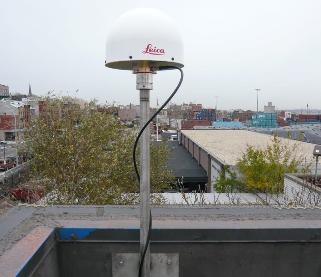
Classical GNSS Reference Station
Setup using expensive hardware, professional installation, thorough documentation, and on-going site management. Site NYBR (2009) from the National Geodetic Survey.geodesy.noaa.gov/CORS/
GNSS Correction Services
Once a dense network of GNSS receivers is available, that data can be used to do more than just RTK. Additional corrections methods were possible. For example, PPK stands for Post-Processing Kinematic and is akin to RTK, but applied after the fact by logging data and apply corrections later. Precise Point Positioning or PPP is another GNSS processing technique which uses additional precise information about GNSS satellites to improve the position accuracy of a GNSS receiver. A network of base stations can monitor for interference and space weather events. Think of these not as base stations, but as reference stations, each monitoring GNSS conditions in a geographic area. Hence the broader class of GNSS correction services was born, of which RTK corrections was just one service.
A Good Size GNSS RTK Network
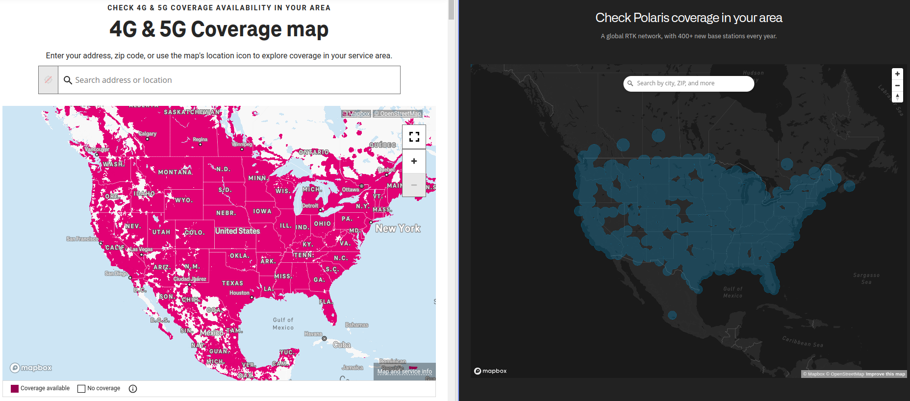
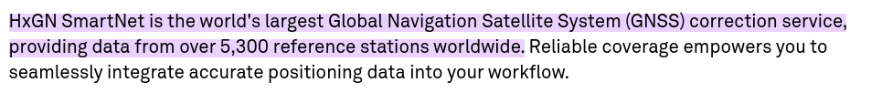
These services were built upon a network of GNSS receivers installed over a geographic area. A denser network allowed for better corrections and the geographic spread allowed for an expanded service area. One analogy might be cell tower coverage. It is typical for commercial providers to show coverage maps and include the number of base or reference stations in their network description (see above picture). Up until recently (2023), several thousand reference stations was a respectable size. The largest networks boasting close to 5,000 stations. This screen grab from the Hexagon product page is an example.
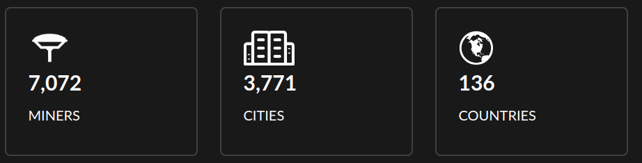
Networks, like that of Hexagon, were developed over several decades and often are the result of acquisitions and aggregations to be what they are today. As a preview of the major shift ahead, in just 3 years GEODNET went from founding to gracefully surpassing these major players in reference station count. This June 25, 2024 screen grab from their website gives the basic stats. No doubt it will have increased, when this article is being read.
How are GNSS Correction Services Traditionally Provided?
Most of the major service providers are now divisions of large GNSS and positioning technology service providers. These services are usually segmented into different products, each targeting specific industries with special accuracy or communication requirements, and sold as subscriptions to the end users. Most major GNSS hardware providers have some form of GNSS correction services.
- Hexagon/Novatel: HxGN SmartNet
- Trimble: RTX
- Tersus: TAP
- u-blox: PointPerfect
- Swift Navigation: SkyLark
- Topcon: Realpoint, skybridge, starpoint
One exception is Septentrio and their Agnostic Corrections Program.
While this list isn't comprehensive, it shows the established market for these services and the model of selling both hardware and software subscriptions. A recent job posting from one of the above companies shows the work that goes into building and managing the CORS network underlying these correction services.
Job Posting: GNSS Reference Network Coordinator
"Now a little more about what you could be doing as part of our team . . . . As a GNSS Reference Network Coordinator on the team you will be responsible for managing the build out and growth of our base station network. This network supports our technologies for autonomous vehicles using advanced GNSS processing techniques."
Under the current model, the setup and on-going maintenance of thousands of GNSS installations distributed over a wide geographic area is nontrivial. To scale this approach to 100,000 reference stations, as is a goal for GEODNET, would be asking for trouble. This is not the model used by GEODNET. Our next article discusses what is changing: What is GEODNET and How Did it Grow So Fast?
FAQ
Can all GPS or GNSS Receivers use Corrections?
No. They must have the software/firmware to support receiving "RTK Corrections".
A growing number of receivers (including on drones and robots) have this option, though it may be a firmware feature with added cost.
Can GNSS Corrections be Applied Afterwards?
Yes. While the first two letters in RTK stands for real-time, there is a parallel service known as PPK where the first two letters stands for post-processing. Software is required to accomplish this.
As with RTK, the receiver must log the requisite raw GNSS measurements. After the fact, GNSS measurements from a nearby base station can also be acquired and the together they are processed to improve accuracy on the original GNSS data. Often PPK can achieve even better accuracy since it has access to more information.