
Article Context
Our last article introduced the growth of GNSS correction services as an important trend to watch this year. These services enable centimeter-level positioning accuracy, an astonishing 100x improvement over the meter-level accuracy of standard GNSS. We now dive deeper into this, namely to cover what exactly are GNSS correction services and the big changes since the emergence and rapid growth of GEODNET.
Earlier this year we joined the GEODNET network and experienced first-hand how this service will be different. Certain elements of the service aligned with our perspectives and thus kept us interested. Navigation and GNSS sensing is among our core technologies and we understand the value provided by GEODNET. Blockchain and reward token economics are new to us, and arguably, the extended navigation business community. Having combined these two technologies, GEODNET is now the world's largest GNSS RTK network, and they have accomplished this in an unprecedented way. This deserves attention. With that, we present to you this two-part article where we answer the following questions:
- Part 1: What are RTK Networks and GNSS Correction Services?
- Part 2: What is GEODNET and How Did it Grow So Fast? (this article)
In these articles we will cover terms like base stations, CORS Network, RTK, PPK, and PPP as well as DePIN, blockchain, space weather miners, and GEOD tokens.
If you like this insight, subscribe for more.
GEODNET
Global Earth Observation Decentralized NETwork
Basic Facts
- Mission 🎯
GEODNET aims to be the worlds largest RTK network built and managed in a largely decentralized manner. The GEODNET Foundation is the formal organization behind this effort to create the requisite community and marketplace. - Founding Team 🙋
The three-member founding team includes two navigation industry veterans, Mike Horton (Project Creator) and Yudan Yi (Head of GNSS), and a blockchain expert David Chen (Head of Blockchain). - Two-Sided Community or Marketplace 🛍️
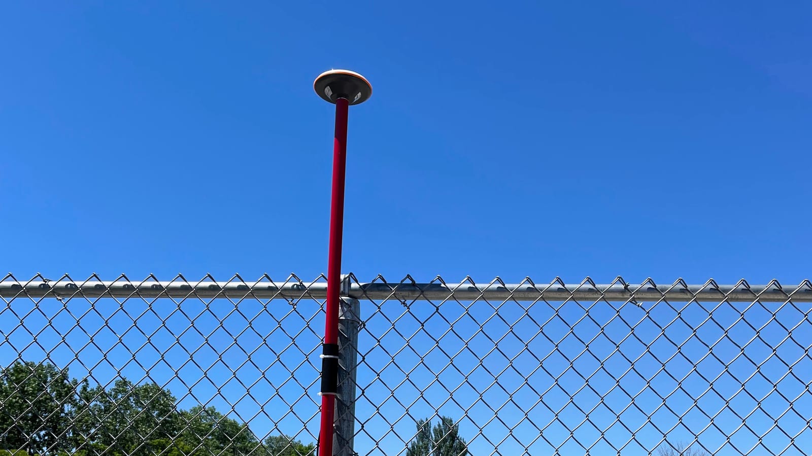
GNSS Data Suppliers: Individuals purchase and setup the requisite GNSS hardware on their properties (also called "satellite miner" or "space weather miner" equipment) and transmit those measurements to GEODNET. Token rewards are given in exchange for quality GNSS data.
GNSS Data Users: Businesses or individuals purchase access to the GNSS reference station data, or RTK corrections, through reseller partners or directly from GEODNET. These purchases are used to reduce the supply of tokens, thus supporting their value. - GEOD Tokens 🪙
Through this exchange, GEOD tokens facilitate the incentives and will have some value which fluctuates. Much of the success of GEODNET will depend on balancing the needs of all stakeholders involved and maintaining the value of these tokens. - DePIN: Decentralized Physical INFrastructure 🏘️
GEODNET is one of several notable DePIN projects which attempt to deploy a network of physical infrastructure without centralized ownership or control of that infrastructure.
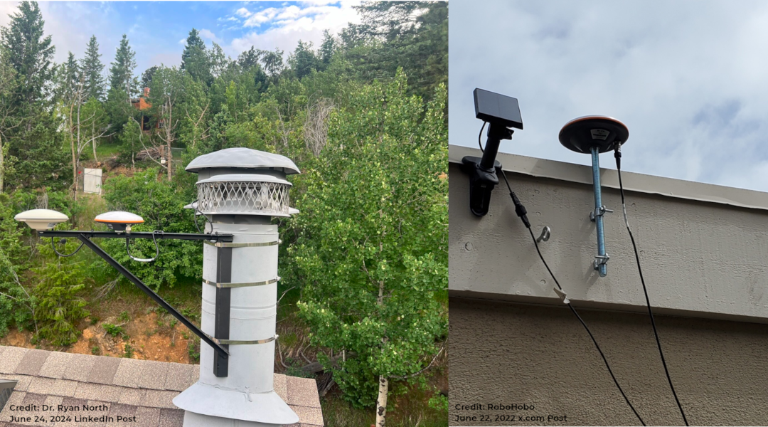
GEODNET Reference Stations
Two of the thousands of sites forming the worlds largest RTK network.
Growing the Network
GEODNET has simplified the task of setting up a GNSS base station and extended the opportunity to almost anyone. The primary requirements are:
- Location: a location where one has rights to install equipment (e.g. a home)
- Sky Visibility: suitable sky visibility for the GNSS antenna
- Internet: data connectivity to facilitate upload of GNSS data
- Power: power source for all equipment involved
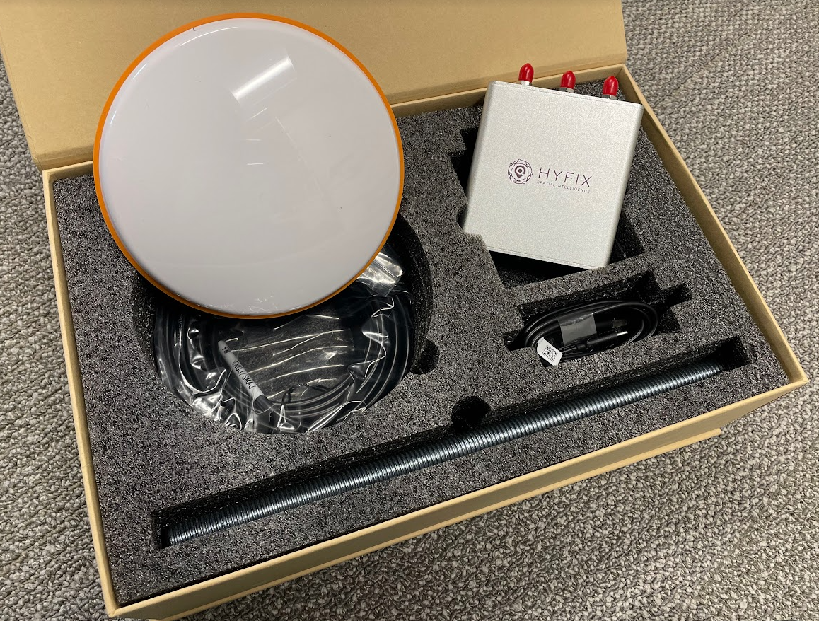
Anyone with the means to do so can buy the hardware kit, also called a Satellite Miner, and extend the GNSS network. The hardware kit includes everything needed for a basic installation. Admittedly, many installations will require some effort and a few iterations to get a reliable setup providing good GNSS signal quality.
GEODNET monitors uptime as well as the GNSS signal quality (i.e. measurement SNR or signal-to-noise ratio). Nearby buildings or trees will impact the SNR which is easily monitored through a web dashboard interface. This is not only useful for optimizing an installation, but the GNSS SNR is also used to calculate token rewards.
GEOD Token Awards
Two key factors go into awarding GEOD tokens:
- Quality of GNSS measurements, as measured by SNR
- Distance to other GEOD base stations
GEODNET defines a hexagonal (hex) pattern and has a reward system assigning tokens for measurements in each hex. The Hex Reward Rules section of the GEODNET documentation explains the details but a simplified explanation is that a hex with a single base station will collect all rewards for that location. Multiple base stations within a single hex will end up sharing the rewards. This creates an incentive to expand coverage while also allowing for redundancy. The intended outcome is a dense network of GNSS base stations with decentralized ownership and management. And this dense network is then valuable for service providers who would sign up for access to this network.
Catapulting Into the Lead
GEODNET GNSS RTK Network
2021: Founded
2024: > 7,000 base stations (world's largest and growing)
The GEODNET organization and incentive structure has facilitated an astonishing growth in reference station count and geographic coverage. This is no small feat for the founding team and their early partners who meticulously and systematically, like good engineers, grew the network and community to this point.
To our knowledge, the application of blockchain to GNSS services is novel. The novelty may also be a source of hesitation for large and established service providers. We, as Organic Navigation, are excited for the emerging opportunities in the GNSS correction space made possible through GEODNET.
Suggested Next Steps
To learn more about GEODNET consider:
- Reading the GEODNET Whitepaper or the online GEOENET Docs
- Joining the Network by purchasing and installing a GEODNET GNSS base station
- Trying the RTK corrections by signing up for a free trial
GEODNET has a number of resale partners which sell both the hardware to extend the network and the subscriptions to get RTK corrections. Among them, EASYNAV.XYZ is an all-in-one partner with worldwide support.
Check them out or visit GEODNET for a full listing of resale partners.